All Locations
Filterable guide to every swimming hole. Click "Details" for full access info, hazards, parking, directions, and recommended months.
18 locations
Harpers Ferry, WV
18 Spots · Waterfalls · Cliff Jumps · Deep Pools
Every swimmable waterfall, river pool, and hidden swimming hole within an hour of Harpers Ferry. Live river gauges, directions, photos, and everything you need to find your spot.
Explore the MapHarpers Ferry sits at the confluence of the Potomac and Shenandoah Rivers, right where West Virginia, Maryland, and Virginia meet. Within an hour's drive you have mountain creeks, wide river pools, spring-fed swimming holes, waterfalls deep in Shenandoah National Park, and quiet lakes with sandy beaches. It's one of the best swimming hole regions on the East Coast.
The karst limestone geology of the Shenandoah Valley creates spring-fed creeks with unusually clear, cool water. Passage Creek in Fort Valley runs through George Washington National Forest with blue-green pools and 25-foot cliff jumps. The Cacapon River offers warm, sandy-bottom swimming through hardwood forest. The Potomac and Shenandoah have wide, accessible swimming areas just minutes from town. And Shenandoah National Park hides some of the most scenic waterfalls and backcountry swimming holes in the eastern U.S.
The spots are organized into three tiers by drive time. Tier 1 (under 30 minutes) includes the Potomac Wayside, Big Eddy, Bloomery Furnace, Dam #4, and Opequon Creek -- quick after-work swims. Tier 2 (30-60 minutes) covers Passage Creek, the Cacapon, Cunningham Falls, and more -- half-day trips. Tier 3 (60+ minutes) reaches Shenandoah National Park waterfalls and backcountry pools -- full day adventures worth the drive.
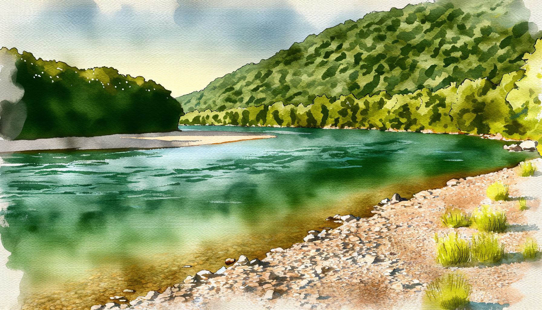
Wide, accessible swimming on the Potomac, Shenandoah, and Cacapon. Warm water, easy access, great for groups.
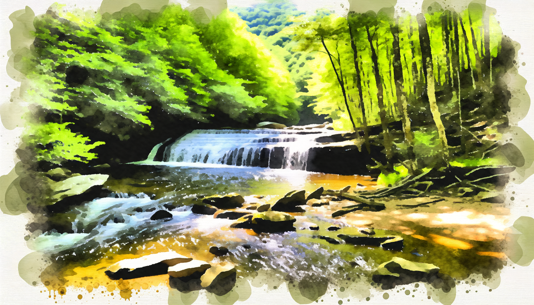
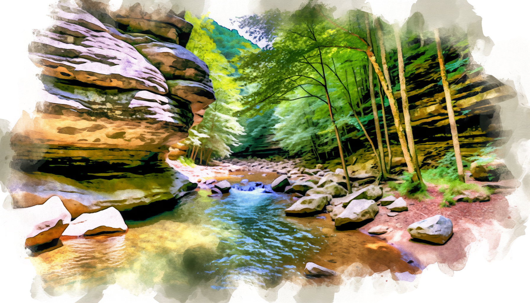
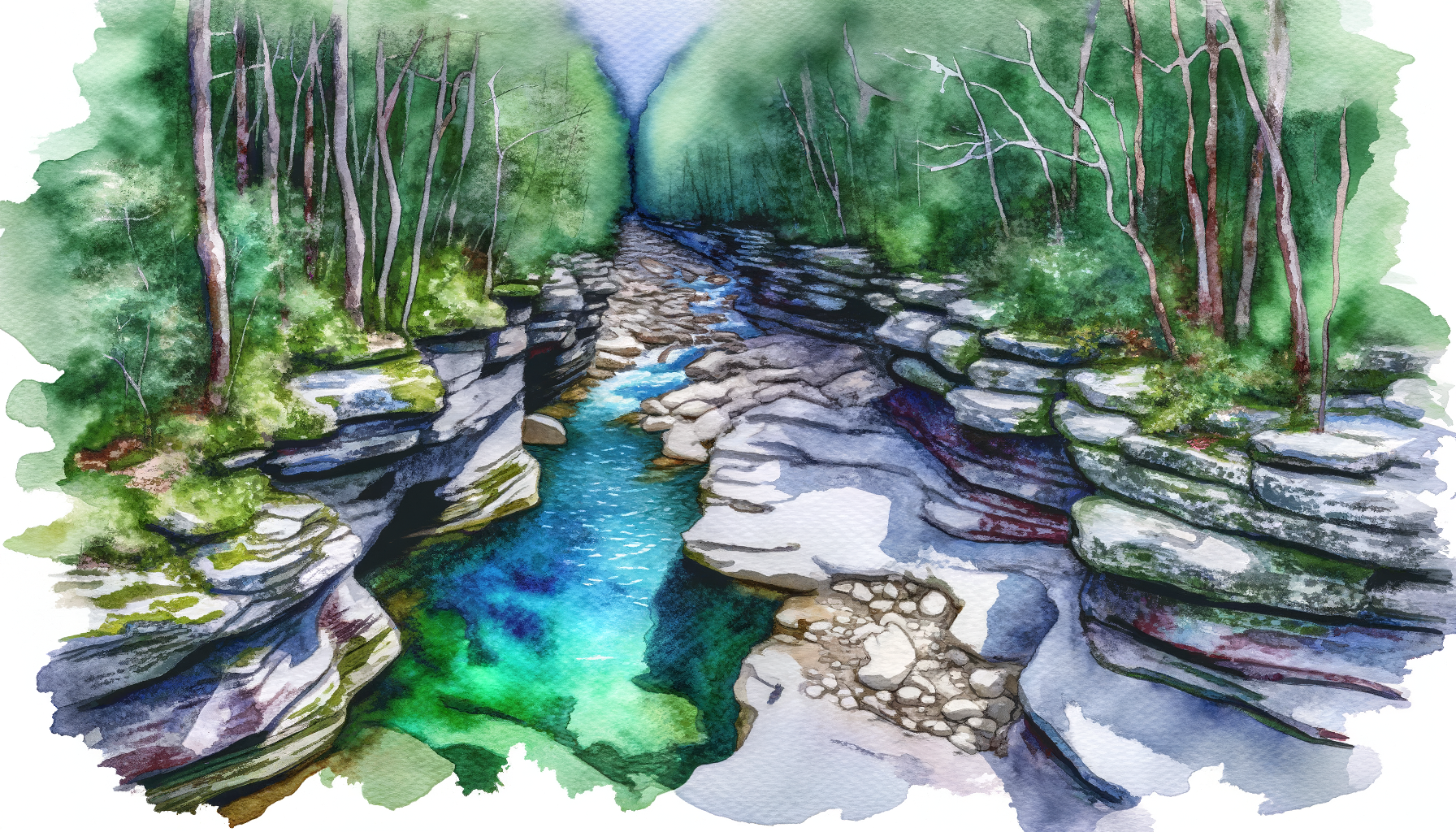
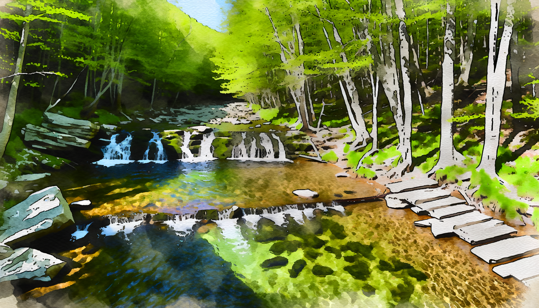
Spring-fed Passage Creek and mountain streams. Cool, clear water with rock ledges, cliff jumps, and blue-green pools.
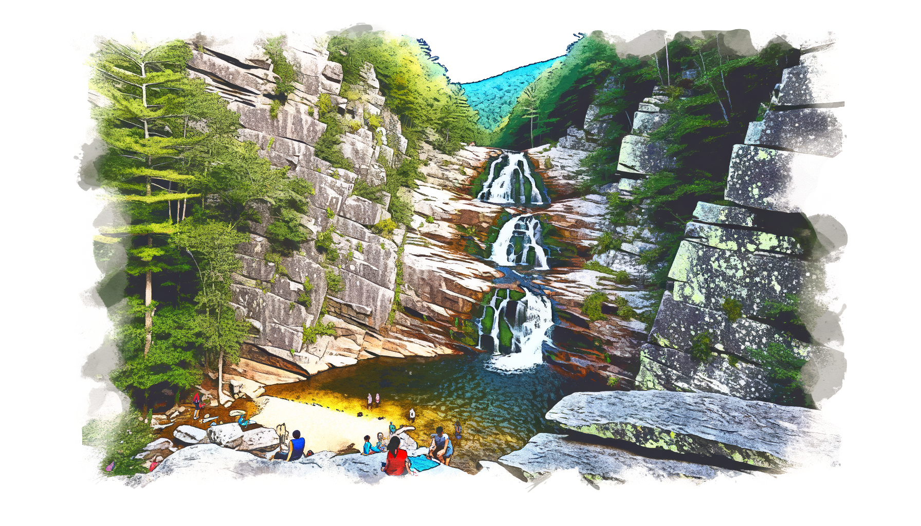
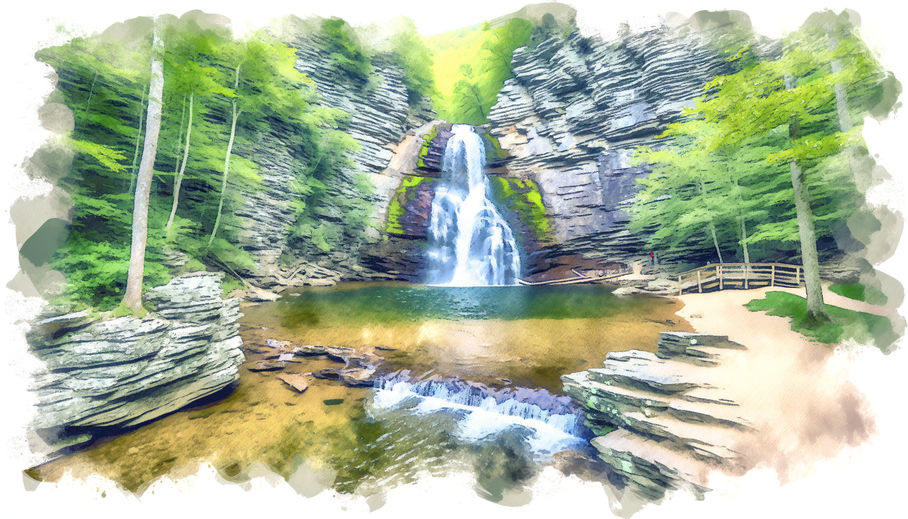
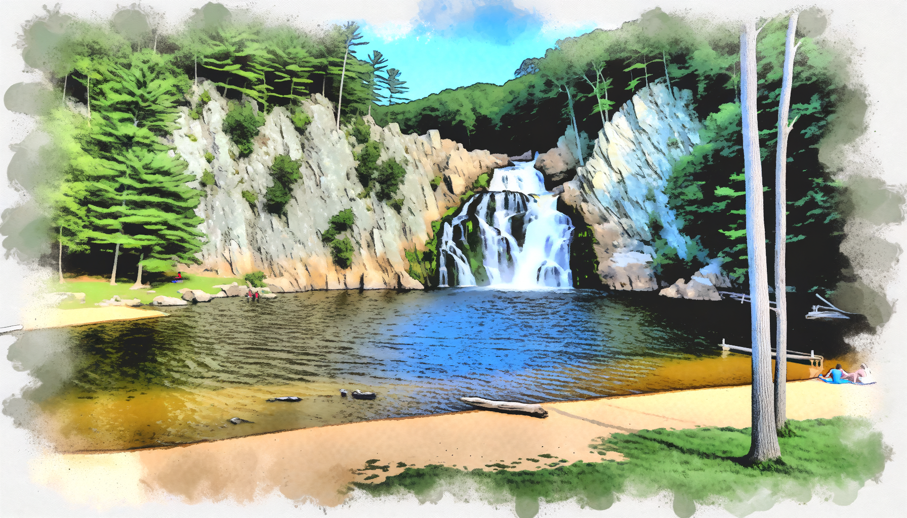
Shenandoah National Park cascades up to 93 feet. Hike-in required but the scenery is world-class.
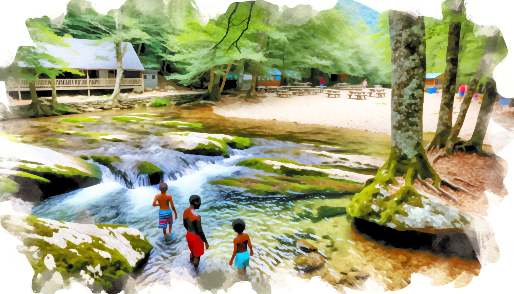
Sleepy Creek Lake and Cunningham Falls State Park. Sandy entry, calm water, family-friendly.
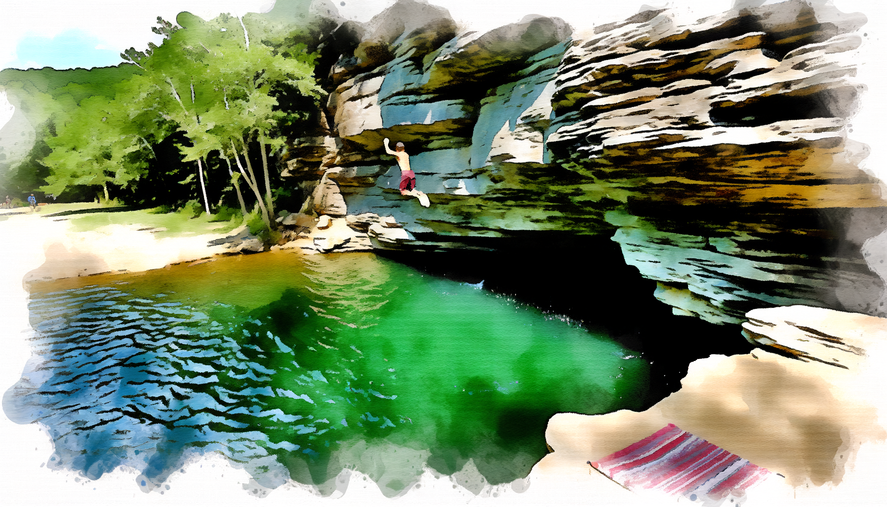
Spring-fed, crystal clear, 25-foot cliff jumps. The best swimming hole in the region, period. 55 min drive but worth every minute.
5 minutes from Harpers Ferry. Wide, shallow Potomac with gravel bars. Perfect for a hot evening when you just need to cool off.
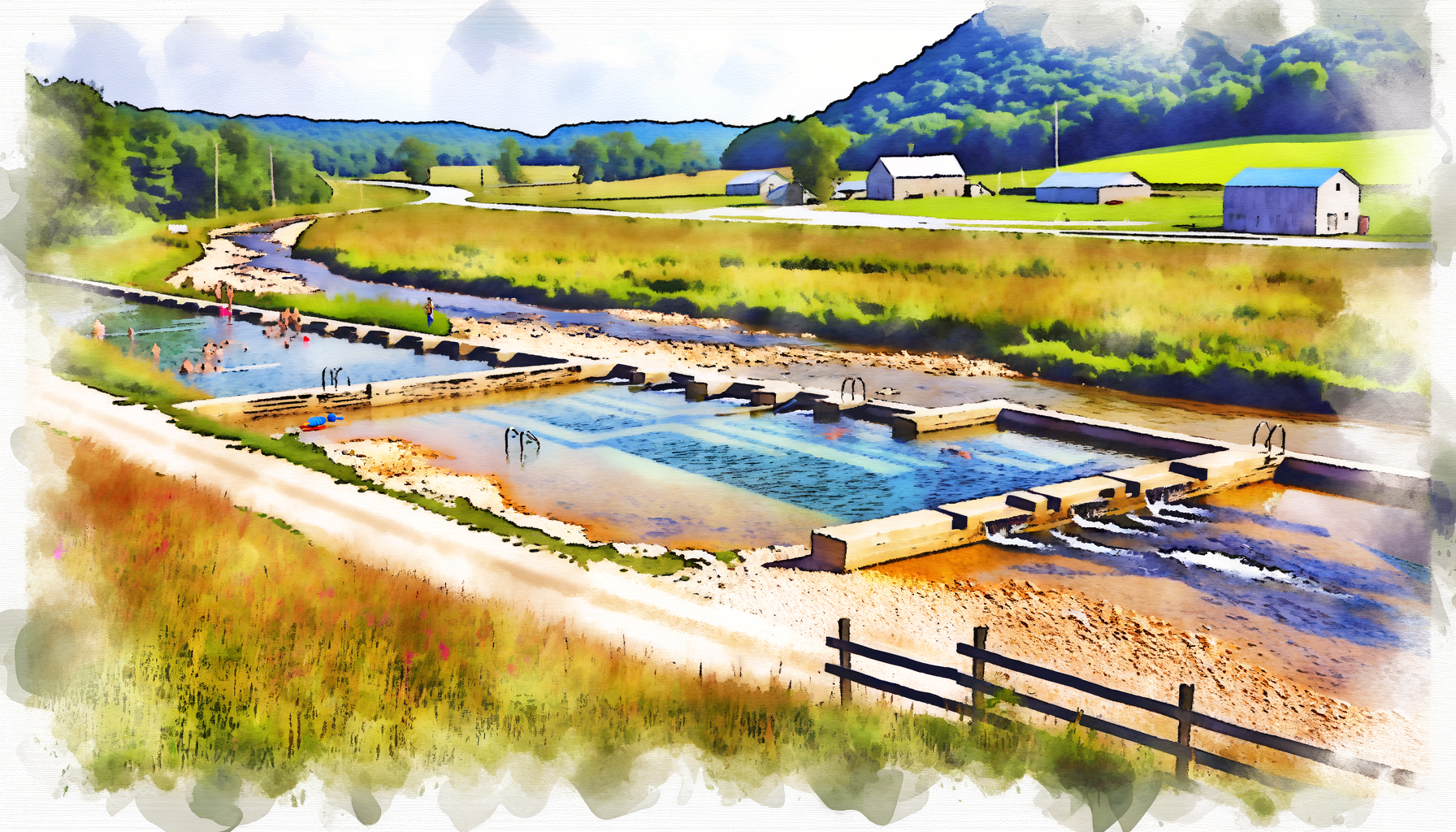
Restrooms, picnic tables, shallow creek. One of the best-equipped spots on this list. Day-use fee but worth it with kids.
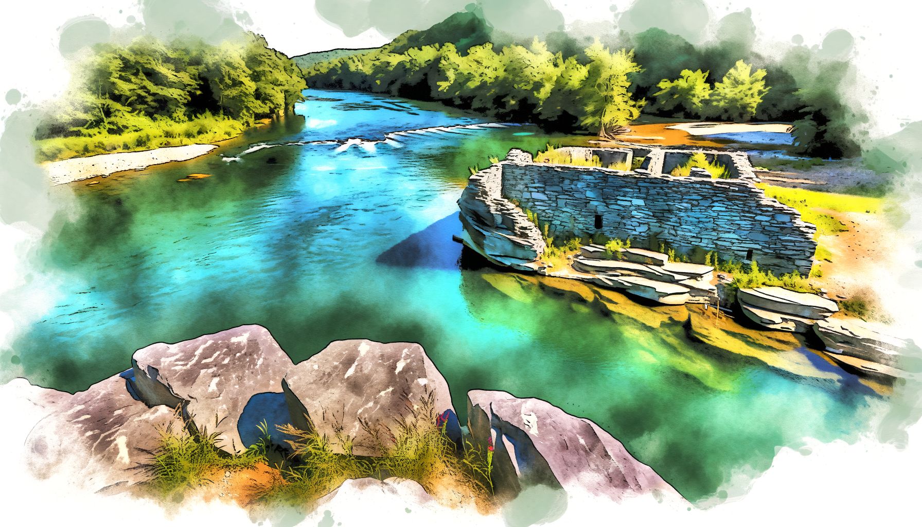
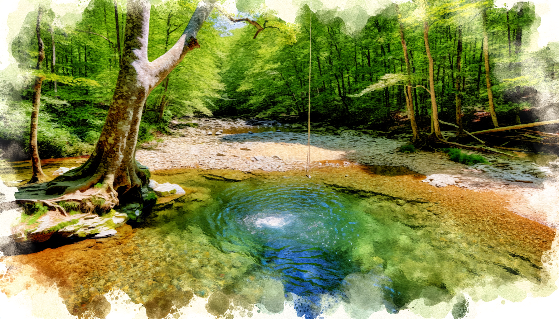
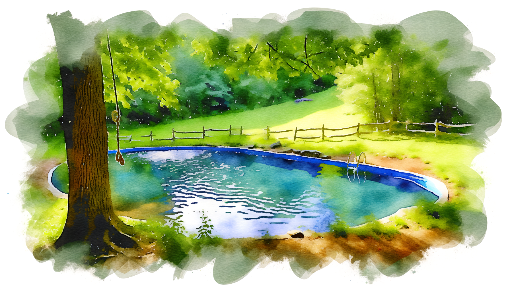
10-15 foot jumps into a deep Shenandoah eddy. Rope swings appear seasonally. 15 minutes from town.
Cacapon tributary with rock ledges and clear water next to historic iron furnace ruins. 20 minutes out. Few people know about it.
Hit Blue Hole, Buzzard Rock, and Elizabeth Furnace in one day. All within 2 miles of each other in George Washington National Forest.
All 18 spots plotted by drive time from Harpers Ferry. Click any marker for details, directions, and photos.
Route 9 West through Martinsburg, then Route 522 South. Bloomery Furnace, Cacapon River, Camp Harding, Sleepy Creek. Rolling farmland and mountain roads. Easy drives, no tricky navigation.
Route 340 South to Front Royal, then Route 55 West into Fort Valley. Blue Hole, Buzzard Rock, Elizabeth Furnace. The drive through Fort Valley on Route 678 is scenic -- limestone cliffs on both sides. The road is paved and fine for any vehicle.
Route 340 South to Front Royal, enter SNP via Skyline Drive. Overall Run is off the northern section. Rose River and Hazel River are deeper in, near milepost 50. Riprap Hollow is in the southern section. Budget time for the 35 mph Skyline Drive speed limit.
Route 340 east into Maryland, then Route 15 North to Thurmont. Cunningham Falls State Park is well-signed. Easy 45-minute drive on divided highway most of the way.
Filterable guide to every swimming hole. Click "Details" for full access info, hazards, parking, directions, and recommended months.
Real-time USGS stream data. For swimming, lower water = safer conditions. Green means good swimming levels. Check before you go.
Volume of water flowing past the gauge. Higher = more water, stronger current. For swimming, you generally want lower numbers. Each gauge has different thresholds because rivers vary in size.
Water level at the gauge station. Useful for tracking trends -- is the river rising or falling? A falling river after rain means conditions are improving.
Check the morning you plan to go. Also check 24 hours before -- you want to see the trend. Rising water = avoid. Stable or falling = generally safe.
Rivers spike 12-48 hours after heavy rain depending on the watershed size. Small creeks spike fast and drop fast. Big rivers like the Potomac take longer to rise and longer to clear.
Live conditions for Harpers Ferry. Water temperature and swim comfort depend on recent weather patterns.
Based on current air temperature and recent conditions. Water temps lag air temps by 1-2 weeks.
Elevation ~250 ft at river level. Valley heat in summer.
Below 75°F, most people won't enjoy swimming in rivers. Above 85°F, you'll want to be in the water. Creek spots stay comfortable even on mild days because of shade.
1-2 days after heavy rain = murky water, higher flows, stronger currents. Wait 48 hours for creeks to clear. Rivers take longer. Check the gauges.
June through August, afternoon pop-up storms are common. They can produce flash flooding in mountain creeks. Check radar before heading to any waterfall or creek spot.
River water lags air temp by 1-2 weeks. Spring-fed creeks (Passage Creek, mountain streams) stay 60-68°F even in August. The Potomac and Cacapon reach 75-80°F in July-August.
Swimming in natural water carries real risk. Know the hazards before you go.
| 911 | All emergencies (WV, VA, MD) |
| (304) 725-8484 | Jefferson County 911 (WV, non-emergency) |
| (304) 535-6029 | Harpers Ferry NHP Visitor Center |
| (540) 636-1446 | Warren County Emergency (VA, Front Royal area) |
| (540) 999-3500 | Shenandoah National Park Emergency |
| (304) 535-6223 | Harpers Ferry Fire & Rescue |
| 1-800-222-1222 | Poison Control |
| Blue Hole | 15-25 ft | Multiple levels, deep pool below |
| Riprap Hollow | 10-20 ft | Boulder jumps, check depth every time |
| Big Eddy | 10-15 ft | River cliff, depth varies with water level |
| Buzzard Rock | 10-12 ft | Rock outcrop over creek pool |
| Bloomery Furnace | 8-10 ft | Rock ledges, lower jumps |
Heights are approximate. Water depth changes with flow. Always check before jumping. A 15-foot jump into 4 feet of water will break your legs or worse.
Most spots near Harpers Ferry have decent cell coverage. The further you get into mountain hollows and national forest, the worse it gets.
Photos from swimming holes across the region. Click any image to view full size.


When to go, what to expect, and which spots are best each month.
Water is still cold. Rivers run higher from spring rain. Best for warm days only. Mountain creeks are at their best flow. Waterfalls are most impressive now.
Season opener for most people. Water warming up. Rivers dropping to swim-safe levels. Weekdays are uncrowded. Thunderstorms pick up in afternoon.
Peak swimming season. Hot days drive everyone to the water. Weekends are packed at popular spots. Go early or go to lesser-known holes. River levels low and calm.
Warmest water temps of the year. Small creeks may run low or dry. Stick to river spots and spring-fed creeks. Passage Creek stays cool. Late August crowds thin as school starts.
Underrated month. Still warm enough to swim, especially early September. Crowds vanish after Labor Day. Some of the best swimming days of the year. Fall color starts late month.
For the hardy. Water is cold but swimmable on warm afternoons. Peak fall foliage makes waterfall hikes spectacular. Go for the scenery, swim if you're brave.
| Month | Best For | Top 3 Picks | Water Temp | Crowds |
|---|---|---|---|---|
| May | Waterfalls, warm afternoons only | Cunningham Falls, Rose River, Overall Run | 58-65°F | Low |
| June | Everything opens up | Blue Hole, Big Eddy, Dam #4 | 65-72°F | Moderate |
| July | Peak swimming, all spots prime | Blue Hole, Cacapon River, Bloomery Furnace | 72-78°F | High |
| August | Warmest water, avoid low creeks | Blue Hole, Potomac Wayside, Sleepy Creek | 74-80°F | High |
| September | Empty spots, still warm | Anywhere -- you'll have it to yourself | 68-74°F | Low |
| October | Foliage hikes, brave swims | Overall Run, Cunningham Falls, Rose River | 58-65°F | None |
Know the rules. Every spot listed here has legal public access, but the rules vary by jurisdiction.
Harpers Ferry National Historical Park manages the Potomac and Shenandoah riverfront in town. Swimming is allowed but not officially encouraged. No lifeguards. The NPS land around Potomac Wayside is open access.
Overall Run, Hazel River, Rose River, and Riprap Hollow are all in SNP. Park pass required to enter via Skyline Drive. Swimming in streams is allowed unless posted otherwise.
Blue Hole, Buzzard Rock, and Elizabeth Furnace are in GWNF. Most areas are free access. Elizabeth Furnace Recreation Area charges a small day-use fee in summer.
Sleepy Creek WMA is managed by WV DNR. Free public access for swimming, fishing, and boating. No developed swimming beach or lifeguards.
Cunningham Falls State Park charges a day-use fee ($3-5 per vehicle) from Memorial Day through Labor Day. The lake beach has lifeguards on duty during posted hours.
Most rivers and creeks in WV and VA have public access at road bridge crossings. You can access the water from the public right-of-way at the bridge, then float or swim in the waterway.
If you brought it in, bring it back out. Beer cans, food wrappers, cigarette butts -- everything. Better yet, pick up trash others left behind.
Bluetooth speakers at full volume ruin it for everyone. People come to these spots for the sound of water, not your playlist.
Don't spread out across the entire area. Leave room for others. If a spot is packed, try a different one -- there are 18 on this list.
Social media blows up swimming holes fast. Share photos, but consider leaving the pin off the map. Locals appreciate it.
Don't spray paint rocks or carve into trees. These places are better without your name on them.
Many of these spots are near homes and farms. Don't block driveways, trespass on private land, or leave gates open.
| Location | Drive | Managing Agency | Fee | Parking | Difficulty |
|---|---|---|---|---|---|
| Potomac Wayside | 5 min | NPS | Free | Gravel pulloff, 10-15 cars | Easy |
| Big Eddy | 15 min | Public ROW | Free | Informal, 6-8 cars | Moderate |
| Bloomery Furnace | 20 min | Public access | Free | Small pulloff, 4-5 cars | Easy |
| Opequon Creek | 20 min | Bridge ROW | Free | Pulloffs, 3-5 cars | Easy |
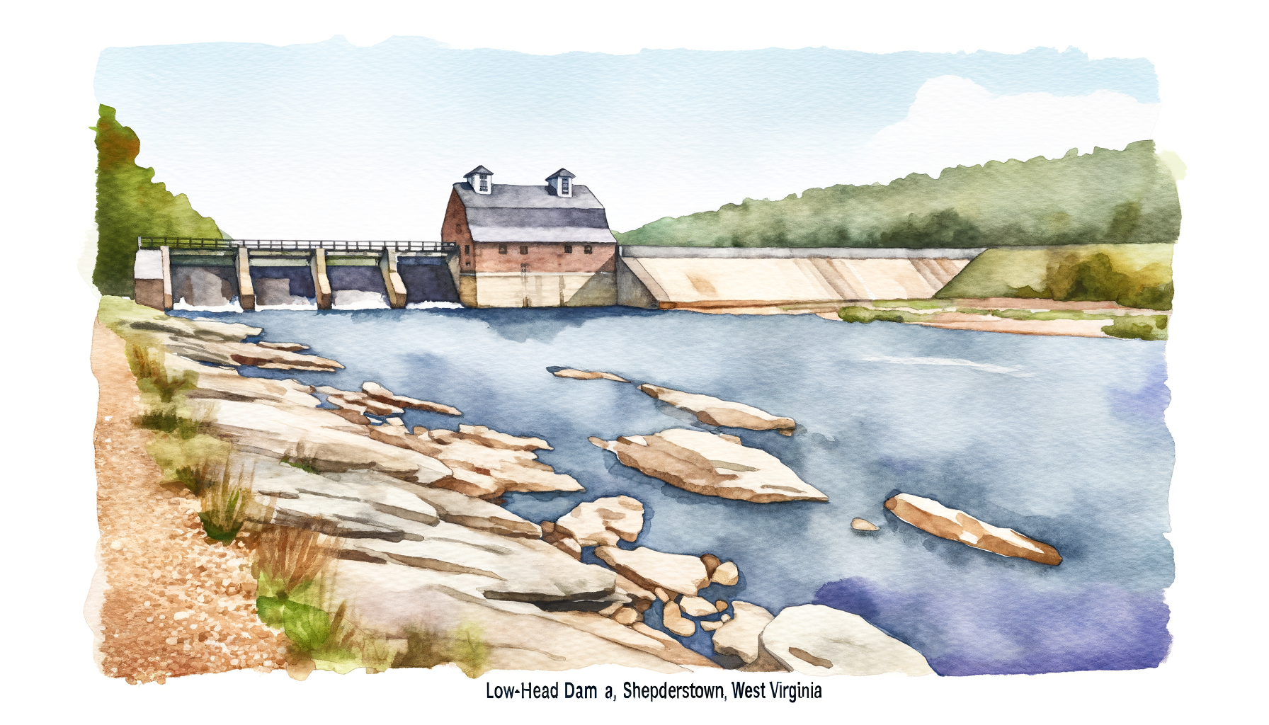
| Dam #4 | 25 min | Public access | Free | Pulloff, 10-12 cars | Easy |
| Camp Harding | 40 min | Public park | Free | Park lot, 15-20 cars | Easy |
| Cunningham Falls | 45 min | MD State Parks | $3-5 | Large paved lots | Easy |
| Sleepy Creek | 45 min | WV DNR | Free | Gravel lot, 20+ cars | Easy |
| Cacapon River | 50 min | Public ROW | Free | Various pulloffs | Easy |
| Blue Hole | 55 min | USFS (GWNF) | Free | Pulloff, 8-10 cars | Easy |
| Buzzard Rock | 55 min | USFS (GWNF) | Free | Pulloff, 5-6 cars | Easy |
| Elizabeth Furnace | 55 min | USFS (GWNF) | $5 | Paved lot, 30+ cars | Easy |
| Gooney Creek | 60 min | Public ROW | Free | Pulloff, 3-4 cars | Moderate |
| Piney River | 65 min | Public ROW | Free | Various pulloffs | Easy |
| Overall Run Falls | 75 min | NPS (SNP) | $30 | Trailhead, 6-8 cars | Hard |
| Rose River Falls | 80 min | NPS (SNP) | $30 | Fishers Gap Overlook | Moderate |
| Hazel River Falls | 90 min | NPS (SNP) | $30 | Trailhead, 8-10 cars | Moderate |
| Riprap Hollow | 120 min | NPS (SNP) | $30 | Skyline Drive trailhead | Hard |